River Conder
River Conder
Jump to navigation
Jump to search
| River Conder | |
|---|---|
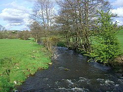 River Conder near Ellel | |
 Location of the mouth within Lancashire | |
| Location | |
| Country | United Kingdom |
| Part | England |
| County | Lancashire |
| Physical characteristics | |
| Mouth | Lune estuary |
- coordinates | 53°59′57.5″N 2°50′0″W / 53.999306°N 2.83333°W / 53.999306; -2.83333Coordinates: 53°59′57.5″N 2°50′0″W / 53.999306°N 2.83333°W / 53.999306; -2.83333 |
The River Conder is a river in the English county of Lancashire.
The source of the River Conder is a spring at Conder Head on Black Fell near Littledale, from where the stream briefly runs north, then west through Cragg Wood. The river then skirts around Quernmore in a southwesterly direction through a disproportionately wide valley, created by glacial action.[1]
The river runs through Ellel and Galgate before turning to the north-west, flowing into the Lune estuary between Conder Green and Glasson.
The name of the river was recorded in the 13th century as Kondover and Kondoure, being derived from Brythonic and meaning "crooked waters".
Notes[edit]
^ Conder Valley, near Lancaster, Ministry of Information. Retrieved 12 September 2006.
| Rivers |
|  |
|---|---|---|
| Canals |
| |
| Others |
| |
This Lancashire location article is a stub. You can help Wikipedia by expanding it. |
This article related to a river in England is a stub. You can help Wikipedia by expanding it. |
Categories:
- Rivers of Lancashire
- Rivers of Lancaster
- Lune catchment
- Lancashire geography stubs
- England river stubs
(window.RLQ=window.RLQ||).push(function()mw.config.set("wgPageParseReport":"limitreport":"cputime":"0.268","walltime":"0.358","ppvisitednodes":"value":1510,"limit":1000000,"ppgeneratednodes":"value":0,"limit":1500000,"postexpandincludesize":"value":60466,"limit":2097152,"templateargumentsize":"value":9271,"limit":2097152,"expansiondepth":"value":12,"limit":40,"expensivefunctioncount":"value":1,"limit":500,"unstrip-depth":"value":0,"limit":20,"unstrip-size":"value":480,"limit":5000000,"entityaccesscount":"value":1,"limit":400,"timingprofile":["100.00% 274.051 1 -total"," 77.66% 212.830 1 Template:Infobox_river"," 69.44% 190.294 1 Template:Infobox"," 16.70% 45.769 1 Template:Both"," 15.19% 41.639 1 Template:Coord"," 9.56% 26.194 3 Template:Navbox"," 7.78% 21.327 1 Template:Location_map"," 5.90% 16.171 1 Template:City_of_Lancaster_geography"," 5.17% 14.161 1 Template:Lancashire-geo-stub"," 4.94% 13.528 1 Template:Rivers_of_Lancashire"],"scribunto":"limitreport-timeusage":"value":"0.104","limit":"10.000","limitreport-memusage":"value":2807909,"limit":52428800,"cachereport":"origin":"mw1306","timestamp":"20181212004248","ttl":1900800,"transientcontent":false);mw.config.set("wgBackendResponseTime":100,"wgHostname":"mw1268"););


