Northfield, Kentucky
Northfield, Kentucky
Jump to navigation
Jump to search
Northfield, Kentucky | |
|---|---|
City | |
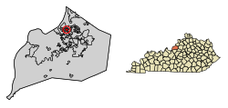 Location of Northfield in Jefferson County, Kentucky | |
 Northfield Location within the state of Kentucky Show map of Kentucky  Northfield Northfield (the US) Show map of the US | |
| Coordinates: 38°17′11″N 85°38′11″W / 38.28639°N 85.63639°W / 38.28639; -85.63639Coordinates: 38°17′11″N 85°38′11″W / 38.28639°N 85.63639°W / 38.28639; -85.63639 | |
| Country | United States |
| State | Kentucky |
| County | Jefferson |
| Incorporated | 1965[1] |
| Area | |
| • Total | 0.47 sq mi (1.22 km2) |
| • Land | 0.47 sq mi (1.22 km2) |
| • Water | 0.0 sq mi (0.0 km2) |
| Elevation | 584 ft (178 m) |
| Population (2010) | |
| • Total | 1,020 |
| • Estimate (2016)[2] | 1,053 |
| • Density | 2,165/sq mi (836.1/km2) |
| Time zone | UTC-5 (Eastern (EST)) |
| • Summer (DST) | UTC-4 (EDT) |
| ZIP Code | 40222 |
| FIPS code | 21-56730 |
GNIS feature ID | 0499602 |
| Website | www.cityofnorthfield.com |
Northfield is a home rule-class city in Jefferson County, Kentucky, United States.[1][3] The population was 1,020 at the 2010 census.[4]
Contents
1 Geography
2 Demographics
3 1974 Tornado damage
4 References
5 External links
Geography[edit]
Northfield is located in northeastern Jefferson County at 38°17′11″N 85°38′11″W / 38.28639°N 85.63639°W / 38.28639; -85.63639 (38.286319, -85.636376).[5] It is bordered to the north by Glenview Manor, to the south by Crossgate, and otherwise by consolidated Louisville/Jefferson County. Downtown Louisville is 8 miles (13 km) to the southwest.
According to the United States Census Bureau, Northfield has a total area of 0.47 square miles (1.22 km2), all land.[4]
Demographics[edit]
| Historical population | |||
|---|---|---|---|
| Census | Pop. | %± | |
| 1970 | 364 | — | |
| 1980 | 906 | 148.9% | |
| 1990 | 898 | −0.9% | |
| 2000 | 970 | 8.0% | |
| 2010 | 1,020 | 5.2% | |
| Est. 2016 | 1,053 | [2] | 3.2% |
| U.S. Decennial Census[6] | |||
As of the census[7] of 2000, there were 970 people, 367 households, and 252 families residing in the city. The population density was 2,196.6 people per square mile (851.2/km²). There were 421 housing units at an average density of 953.4 per square mile (369.4/km²). The racial makeup of the city was 94.43% White, 4.23% African American, 1.24% Asian, and 0.10% from two or more races. Hispanic or Latino of any race were 0.82% of the population.
There were 367 households out of which 27.2% had children under the age of 18 living with them, 62.4% were married couples living together, 5.2% had a female householder with no husband present, and 31.3% were non-families. 27.0% of all households were made up of individuals and 9.8% had someone living alone who was 65 years of age or older. The average household size was 2.32 and the average family size was 2.85.
In the city, the population was spread out with 19.8% under the age of 18, 3.9% from 18 to 24, 22.1% from 25 to 44, 26.3% from 45 to 64, and 27.9% who were 65 years of age or older. The median age was 49 years. For every 100 females, there were 81.6 males. For every 100 females age 18 and over, there were 82.6 males.
The median income for a household in the city was $83,752, and the median income for a family was $105,620. Males had a median income of $82,403 versus $40,000 for females. The per capita income for the city was $41,490. None of the families and 1.5% of the population were living below the poverty line, including no under eighteens and 3.0% of those over 64.
1974 Tornado damage[edit]
Northfield was one of the hardest hit neighborhoods when Louisville was hit by an F4 tornado on April 3, 1974. This tornado was part of the 1974 Super Outbreak of 148 tornadoes that hit 13 U.S. states and one Canadian province.
References[edit]
^ ab Commonwealth of Kentucky. Office of the Secretary of State. Land Office. "Northfield, Kentucky". Accessed 15 September 2013.
^ ab "Population and Housing Unit Estimates". Retrieved June 9, 2017..mw-parser-output cite.citationfont-style:inherit.mw-parser-output qquotes:"""""""'""'".mw-parser-output code.cs1-codecolor:inherit;background:inherit;border:inherit;padding:inherit.mw-parser-output .cs1-lock-free abackground:url("//upload.wikimedia.org/wikipedia/commons/thumb/6/65/Lock-green.svg/9px-Lock-green.svg.png")no-repeat;background-position:right .1em center.mw-parser-output .cs1-lock-limited a,.mw-parser-output .cs1-lock-registration abackground:url("//upload.wikimedia.org/wikipedia/commons/thumb/d/d6/Lock-gray-alt-2.svg/9px-Lock-gray-alt-2.svg.png")no-repeat;background-position:right .1em center.mw-parser-output .cs1-lock-subscription abackground:url("//upload.wikimedia.org/wikipedia/commons/thumb/a/aa/Lock-red-alt-2.svg/9px-Lock-red-alt-2.svg.png")no-repeat;background-position:right .1em center.mw-parser-output .cs1-subscription,.mw-parser-output .cs1-registrationcolor:#555.mw-parser-output .cs1-subscription span,.mw-parser-output .cs1-registration spanborder-bottom:1px dotted;cursor:help.mw-parser-output .cs1-hidden-errordisplay:none;font-size:100%.mw-parser-output .cs1-visible-errorfont-size:100%.mw-parser-output .cs1-subscription,.mw-parser-output .cs1-registration,.mw-parser-output .cs1-formatfont-size:95%.mw-parser-output .cs1-kern-left,.mw-parser-output .cs1-kern-wl-leftpadding-left:0.2em.mw-parser-output .cs1-kern-right,.mw-parser-output .cs1-kern-wl-rightpadding-right:0.2em
^ "Summary and Reference Guide to House Bill 331 City Classification Reform" (PDF). Kentucky League of Cities. Retrieved December 30, 2014.
^ ab "Geographic Identifiers: 2010 Census Summary File 1 (G001): Northfield city, Kentucky". American Factfinder. U.S. Census Bureau. Retrieved June 15, 2018.
^ "US Gazetteer files: 2010, 2000, and 1990". United States Census Bureau. 2011-02-12. Retrieved 2011-04-23.
^ "Census of Population and Housing". Census.gov. Retrieved June 4, 2015.
^ "American FactFinder". United States Census Bureau. Retrieved 2008-01-31.
External links[edit]
- City of Northfield official website
Municipalities and communities of Jefferson County, Kentucky, United States | ||
|---|---|---|
County seat: Louisville | ||
| Cities |
|  |
| Former CDPs |
| |
| Footnotes | ‡This populated place also has portions in an adjacent county or counties | |
Louisville, Kentucky (metro area) | ||
|---|---|---|
| History |
|  |
| Geography |
| |
| Government |
| |
| Transportation |
| |
| Other subject areas |
| |
| Top subjects |
| |
| National Historic Landmarks |
| |
| Prominent suburbs (over 10K pop.) |
| |
| ||
Categories:
- Cities in Jefferson County, Kentucky
- Cities in Kentucky
- Populated places established in 1965
- 1965 establishments in Kentucky
(window.RLQ=window.RLQ||).push(function()mw.config.set("wgPageParseReport":"limitreport":"cputime":"0.596","walltime":"0.772","ppvisitednodes":"value":4501,"limit":1000000,"ppgeneratednodes":"value":0,"limit":1500000,"postexpandincludesize":"value":136877,"limit":2097152,"templateargumentsize":"value":16211,"limit":2097152,"expansiondepth":"value":23,"limit":40,"expensivefunctioncount":"value":2,"limit":500,"unstrip-depth":"value":1,"limit":20,"unstrip-size":"value":16255,"limit":5000000,"entityaccesscount":"value":1,"limit":400,"timingprofile":["100.00% 601.737 1 -total"," 61.39% 369.427 1 Template:Infobox_settlement"," 37.61% 226.320 1 Template:Infobox"," 18.97% 114.174 1 Template:Reflist"," 16.45% 98.961 6 Template:Cite_web"," 10.34% 62.204 1 Template:Short_description"," 7.38% 44.406 3 Template:Infobox_settlement/areadisp"," 7.15% 43.045 3 Template:Navbox"," 6.62% 39.827 7 Template:Both"," 6.31% 37.965 2 Template:Coord"],"scribunto":"limitreport-timeusage":"value":"0.229","limit":"10.000","limitreport-memusage":"value":6359011,"limit":52428800,"cachereport":"origin":"mw1327","timestamp":"20181225025215","ttl":1900800,"transientcontent":false););"@context":"https://schema.org","@type":"Article","name":"Northfield, Kentucky","url":"https://en.wikipedia.org/wiki/Northfield,_Kentucky","sameAs":"http://www.wikidata.org/entity/Q2469590","mainEntity":"http://www.wikidata.org/entity/Q2469590","author":"@type":"Organization","name":"Contributors to Wikimedia projects","publisher":"@type":"Organization","name":"Wikimedia Foundation, Inc.","logo":"@type":"ImageObject","url":"https://www.wikimedia.org/static/images/wmf-hor-googpub.png","datePublished":"2002-10-20T22:31:45Z","dateModified":"2018-06-15T18:51:58Z","image":"https://upload.wikimedia.org/wikipedia/commons/8/84/USA_Kentucky_location_map.svg"(window.RLQ=window.RLQ||).push(function()mw.config.set("wgBackendResponseTime":105,"wgHostname":"mw1265"););


