Perry Township, Armstrong County, Pennsylvania
Perry Township, Armstrong County, Pennsylvania
Jump to navigation
Jump to search
Perry Township, Armstrong County, Pennsylvania | |
|---|---|
Township | |
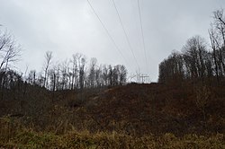 A small clearing in the township's dense woodlands | |
 Map of Armstrong County, Pennsylvania highlighting Perry Township | |
 Map of Armstrong County, Pennsylvania | |
| Country | United States |
| State | Pennsylvania |
| County | Armstrong |
| Settled | 1796 |
| Incorporated | 1845 |
| Area [1] | |
| • Total | 15.02 sq mi (38.91 km2) |
| • Land | 15.02 sq mi (38.91 km2) |
| • Water | 0.00 sq mi (0.00 km2) |
| Population (2010) | |
| • Total | 352 |
| • Estimate (2016)[2] | 337 |
| • Density | 22.43/sq mi (8.66/km2) |
| Time zone | UTC-5 (Eastern (EST)) |
| • Summer (DST) | UTC-4 (EDT) |
| FIPS code | 42-005-59440 |
Perry Township is a township in Armstrong County, Pennsylvania, United States. The population was 352 at the 2010 census.[3]
Contents
1 Geography
2 Recreation
3 Demographics
4 Education
5 History
6 Cemeteries
7 References
Geography[edit]
Perry Township is located in northern Armstrong County, between the west bank of the Allegheny River and the western county boundary. It is bordered to the north by the city of Parker.
According to the United States Census Bureau, the township has a total area of 15.0 square miles (38.9 km2), all of it land.[3]
Recreation[edit]
A portion of the Pennsylvania State Game Lands Number 105 is located in Perry Township at the confluence of Birch Run with the Allegheny River.[4][5]
Demographics[edit]
| Historical population | |||
|---|---|---|---|
| Census | Pop. | %± | |
| 2010 | 352 | — | |
| Est. 2016 | 337 | [2] | −4.3% |
| U.S. Decennial Census[6] | |||
As of the census[7] of 2000, there were 404 people, 154 households, and 119 families residing in the township. The population density was 26.9 people per square mile (10.4/km²). There were 263 housing units at an average density of 17.5/sq mi (6.8/km²). The racial makeup of the township was 99.75% White, and 0.25% from two or more races. Hispanic or Latino of any race were 0.25% of the population.
There were 154 households, out of which 32.5% had children under the age of 18 living with them, 64.3% were married couples living together, 9.1% had a female householder with no husband present, and 22.7% were non-families. 19.5% of all households were made up of individuals, and 7.8% had someone living alone who was 65 years of age or older. The average household size was 2.62 and the average family size was 2.92.
The township median age of 39 years was slightly less than the county median age of 40 years. The distribution by age group was 24.5% under the age of 18, 5.4% from 18 to 24, 30.7% from 25 to 44, 25.5% from 45 to 64, and 13.9% who were 65 years of age or older. The median age was 39 years. For every 100 females there were 98.0 males. For every 100 females age 18 and over, there were 108.9 males.
The median income for a household in the township was $32,083, and the median income for a family was $40,469. Males had a median income of $31,250 versus $26,250 for females. The per capita income for the township was $22,784. About 11.1% of families and 11.8% of the population were below the poverty line, including 11.0% of those under age 18 and 3.8% of those age 65 or over.
Education[edit]
Karns City Area School District - public schools
Karns City High School in neighboring Butler County
History[edit]
Perry Township appears in the 1876 Atlas of Armstrong County, Pennsylvania.[8]
Cemeteries[edit]
- Crawford Cemetery[9]
- Robinson Cemetery[10]
- Saints Peter and Paul Cemetery[11]
- Shakley Cemetery[12]
- Walley Cemetery[13]
References[edit]
^ "2016 U.S. Gazetteer Files". United States Census Bureau. Retrieved Aug 13, 2017..mw-parser-output cite.citationfont-style:inherit.mw-parser-output .citation qquotes:"""""""'""'".mw-parser-output .citation .cs1-lock-free abackground:url("//upload.wikimedia.org/wikipedia/commons/thumb/6/65/Lock-green.svg/9px-Lock-green.svg.png")no-repeat;background-position:right .1em center.mw-parser-output .citation .cs1-lock-limited a,.mw-parser-output .citation .cs1-lock-registration abackground:url("//upload.wikimedia.org/wikipedia/commons/thumb/d/d6/Lock-gray-alt-2.svg/9px-Lock-gray-alt-2.svg.png")no-repeat;background-position:right .1em center.mw-parser-output .citation .cs1-lock-subscription abackground:url("//upload.wikimedia.org/wikipedia/commons/thumb/a/aa/Lock-red-alt-2.svg/9px-Lock-red-alt-2.svg.png")no-repeat;background-position:right .1em center.mw-parser-output .cs1-subscription,.mw-parser-output .cs1-registrationcolor:#555.mw-parser-output .cs1-subscription span,.mw-parser-output .cs1-registration spanborder-bottom:1px dotted;cursor:help.mw-parser-output .cs1-ws-icon abackground:url("//upload.wikimedia.org/wikipedia/commons/thumb/4/4c/Wikisource-logo.svg/12px-Wikisource-logo.svg.png")no-repeat;background-position:right .1em center.mw-parser-output code.cs1-codecolor:inherit;background:inherit;border:inherit;padding:inherit.mw-parser-output .cs1-hidden-errordisplay:none;font-size:100%.mw-parser-output .cs1-visible-errorfont-size:100%.mw-parser-output .cs1-maintdisplay:none;color:#33aa33;margin-left:0.3em.mw-parser-output .cs1-subscription,.mw-parser-output .cs1-registration,.mw-parser-output .cs1-formatfont-size:95%.mw-parser-output .cs1-kern-left,.mw-parser-output .cs1-kern-wl-leftpadding-left:0.2em.mw-parser-output .cs1-kern-right,.mw-parser-output .cs1-kern-wl-rightpadding-right:0.2em
^ ab "Population and Housing Unit Estimates". Retrieved June 9, 2017.
^ ab "Geographic Identifiers: 2010 Demographic Profile Data (G001): Perry township, Armstrong County, Pennsylvania". U.S. Census Bureau, American Factfinder. Retrieved August 1, 2013.
^ https://viewer.nationalmap.gov/advanced-viewer/ The National Map, retrieved 13 September 2018
^ Pennsylvania State Game Lands, retrieved 15 September 2018
^ "Census of Population and Housing". Census.gov. Retrieved June 4, 2016.
^ "American FactFinder". United States Census Bureau. Retrieved 2008-01-31.
^ "Atlas of Armstrong County Pennsylvania, page 57". Pomeroy, Whitman & Co. 1876. Retrieved 9 November 2018.
^ "Crawford Cemetery". Geographic Names Information System. United States Geological Survey.
^ "Robinson Cemetery". Geographic Names Information System. United States Geological Survey.
^ "Saints Peter and Paul Cemetery". Geographic Names Information System. United States Geological Survey.
^ "Shakley Cemetery". Geographic Names Information System. United States Geological Survey.
^ "Walley Cemetery". Geographic Names Information System. United States Geological Survey.
Municipalities and communities of Armstrong County, Pennsylvania, United States | ||
|---|---|---|
County seat: Kittanning | ||
| City |
|  |
| Boroughs |
| |
| Townships |
| |
| CDPs |
| |
| Unincorporated communities |
| |
Pittsburgh metropolitan area | ||
|---|---|---|
| Counties |
|  Map of the Pittsburgh Tri-State with green counties in the metropolitan area and yellow counties in the combined area. |
| Major cities |
| |
| Cities and towns 15k–50k (in 2010) |
| |
| Airports |
| |
| Topics |
| |
| ||
Coordinates: 41°01′29″N 79°39′50″W / 41.02472°N 79.66389°W / 41.02472; -79.66389
Categories:
- Populated places established in 1796
- Townships in Armstrong County, Pennsylvania
- 1845 establishments in Pennsylvania
(window.RLQ=window.RLQ||).push(function()mw.config.set("wgPageParseReport":"limitreport":"cputime":"0.532","walltime":"0.684","ppvisitednodes":"value":4045,"limit":1000000,"ppgeneratednodes":"value":0,"limit":1500000,"postexpandincludesize":"value":98630,"limit":2097152,"templateargumentsize":"value":8832,"limit":2097152,"expansiondepth":"value":14,"limit":40,"expensivefunctioncount":"value":2,"limit":500,"unstrip-depth":"value":1,"limit":20,"unstrip-size":"value":32711,"limit":5000000,"entityaccesscount":"value":1,"limit":400,"timingprofile":["100.00% 546.924 1 -total"," 37.95% 207.581 1 Template:Infobox_settlement"," 29.16% 159.462 1 Template:Reflist"," 23.66% 129.397 11 Template:Cite_web"," 20.33% 111.183 1 Template:Infobox"," 5.91% 32.344 5 Template:Cite_gnis"," 5.90% 32.266 1 Template:US_Census_population"," 5.85% 32.011 1 Template:Convert"," 5.71% 31.230 1 Template:Other_Pennsylvania_townships"," 5.56% 30.403 1 Template:Coord"],"scribunto":"limitreport-timeusage":"value":"0.217","limit":"10.000","limitreport-memusage":"value":5843512,"limit":52428800,"cachereport":"origin":"mw1244","timestamp":"20190322131051","ttl":2592000,"transientcontent":false);mw.config.set("wgBackendResponseTime":132,"wgHostname":"mw1274"););


