Powell River (Tennessee River tributary)
| Powell River | |
| River | |
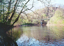 The Powell River near Harrogate in Claiborne County, Tennessee | |
| Country | United States |
|---|---|
| States | Virginia, Tennessee |
| Source | Indian Mountain in Wise County, Virginia |
| - elevation | 3,490 ft (1,064 m) [2] |
| - coordinates | 37°01′51″N 82°42′25″W / 37.03083°N 82.70694°W / 37.03083; -82.70694 [2] |
| Mouth | Clinch River in Union County, Tennessee |
| - elevation | 1,020 ft (311 m) [2] |
| - coordinates | 36°17′49″N 84°01′34″W / 36.29694°N 84.02611°W / 36.29694; -84.02611Coordinates: 36°17′49″N 84°01′34″W / 36.29694°N 84.02611°W / 36.29694; -84.02611 [3] |
| Length | 195.5 mi (315 km) [1] |
| Basin | 954 sq mi (2,471 km2) [5] |
| Discharge | for US-25E bridge near Arthur, Tennessee, 65.4 miles (105.3 km) above the mouth |
| - average | 1,157 cu ft/s (33 m3/s) (mean for water years 1919-1979)[4] |
| - max | 59,500 cu ft/s (1,685 m3/s) April 1977[4] |
| - min | 47 cu ft/s (1.3 m3/s) January 1940[4] |
 The Powell drainage basin | |
The Powell River in the United States rises in southwest Virginia and flows into East Tennessee.
The river rises in rural Wise County, Virginia, near the Laurel Grove community northwest of Norton and flows for several miles before the confluence with Roaring Fork in the Kent Junction community. From Kent Junction the river flows 187 miles (301 km) and drains approximately 954 square miles (2,471 km2) in both Virginia and Tennessee before reaching its confluence with the Clinch River in the Norris Lake reservoir at the site of the now-submerged town of Grantsboro.
Powell River was named for a man called Powell who apparently carved his name into many of the trees of the area while accompanying the exploration party of Dr. Thomas Walker in the mid-18th century. His name appeared so frequently on trees in the valley of this river that later explorers and early pioneers came to call the stream "Powell's River" and the valley "Powell's Valley".[6]
The Powell River was designated by the EPA as the “second most biologically diverse aquatic system in the nation.”[7] The Powell is under pressure from the effects of mining (including strip mining), logging and associated road-building.
Lincoln Memorial University operates the Powell River Aquatic Research Station, which is located where Tennessee State Route 63 crosses the river at the Brooks Bridge in Claiborne County, Tennessee. The center, which opened in April 2008, allows for on-site research of water quality, flora, fauna and related habitat.[8]
References
^ Obtained from adding the length of the Tennessee section of the river, indicated as 115.5 miles on USGS topographical maps, to the Virginia section of the river, indicated as 80 miles on the Virginia Department of Game and Inland Fisheries website.
^ abc U.S. Geological Survey Geographic Names Information System: Powell River
^ U.S. Geological Survey. Demory, TN. 1:24,000. Coordinates given for the mouth in GNIS (36.4996300, -83.672000) refer to a point 56 miles upstream from the river's mouth.
^ abc United States Geological Survey, Water Resources Data Tennessee: Water Year 1979, Water Data Report TN-79-1, p. 199. Gaging station 03532000.
^ "Powell River Watershed (06010206) of the Tennessee River Basin: Water Quality Management Plan," Tennessee Department of Environment and Conservation website, 2008. Retrieved: 8 June 2015.
^ Collins, Lewis (1877). History of Kentucky. p. 416..mw-parser-output cite.citationfont-style:inherit.mw-parser-output qquotes:"""""""'""'".mw-parser-output code.cs1-codecolor:inherit;background:inherit;border:inherit;padding:inherit.mw-parser-output .cs1-lock-free abackground:url("//upload.wikimedia.org/wikipedia/commons/thumb/6/65/Lock-green.svg/9px-Lock-green.svg.png")no-repeat;background-position:right .1em center.mw-parser-output .cs1-lock-limited a,.mw-parser-output .cs1-lock-registration abackground:url("//upload.wikimedia.org/wikipedia/commons/thumb/d/d6/Lock-gray-alt-2.svg/9px-Lock-gray-alt-2.svg.png")no-repeat;background-position:right .1em center.mw-parser-output .cs1-lock-subscription abackground:url("//upload.wikimedia.org/wikipedia/commons/thumb/a/aa/Lock-red-alt-2.svg/9px-Lock-red-alt-2.svg.png")no-repeat;background-position:right .1em center.mw-parser-output .cs1-subscription,.mw-parser-output .cs1-registrationcolor:#555.mw-parser-output .cs1-subscription span,.mw-parser-output .cs1-registration spanborder-bottom:1px dotted;cursor:help.mw-parser-output .cs1-hidden-errordisplay:none;font-size:100%.mw-parser-output .cs1-visible-errorfont-size:100%.mw-parser-output .cs1-subscription,.mw-parser-output .cs1-registration,.mw-parser-output .cs1-formatfont-size:95%.mw-parser-output .cs1-kern-left,.mw-parser-output .cs1-kern-wl-leftpadding-left:0.2em.mw-parser-output .cs1-kern-right,.mw-parser-output .cs1-kern-wl-rightpadding-right:0.2em
^ Jefferson National Forest (N.F.), Revised Land and Resource Management Plan: Environmental Impact Statement. United States Forest Service. 2004. pp. 4–32. Retrieved 19 October 2016.
^ LMU OPENS POWELL RIVER AQUATIC RESEARCH STATION, Lincoln Memorial University press release
See also
- List of Tennessee rivers
- List of Virginia rivers
- Big Stone Gap, Virginia

 Clash Royale CLAN TAG#URR8PPP


