Loriol-sur-Drôme
Loriol-sur-Drôme
Jump to navigation
Jump to search
Loriol-sur-Drôme | ||
|---|---|---|
Commune | ||
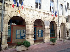 Town hall | ||
| ||
 Loriol-sur-Drôme Location of Loriol-sur-Drôme Show map of France  Loriol-sur-Drôme Loriol-sur-Drôme (Auvergne-Rhône-Alpes) Show map of Auvergne-Rhône-Alpes | ||
| Coordinates: 44°45′09″N 4°49′24″E / 44.7525°N 4.8233°E / 44.7525; 4.8233Coordinates: 44°45′09″N 4°49′24″E / 44.7525°N 4.8233°E / 44.7525; 4.8233 | ||
| Country | France | |
| Region | Auvergne-Rhône-Alpes | |
| Department | Drôme | |
| Arrondissement | Die | |
| Canton | Loriol-sur-Drôme | |
| Intercommunality | Val de Drôme | |
| Government | ||
| • Mayor .mw-parser-output .noboldfont-weight:normal (2008–2014) | Jacques Ladegaillerie | |
| Area 1 | 28.66 km2 (11.07 sq mi) | |
| Population (2008)2 | 5,745 | |
| • Density | 200/km2 (520/sq mi) | |
| Time zone | UTC+01:00 (CET) | |
| • Summer (DST) | UTC+02:00 (CEST) | |
INSEE/Postal code | 26166 /26270 | |
| Elevation | 81–365 m (266–1,198 ft) (avg. 108 m or 354 ft) | |
1 French Land Register data, which excludes lakes, ponds, glaciers > 1 km2 (0.386 sq mi or 247 acres) and river estuaries. 2Population without double counting: residents of multiple communes (e.g., students and military personnel) only counted once. | ||

Loriol-sur-Drôme (Vivaro-Alpine: L’Auriòu de Droma) is a commune in the Drôme department in southeastern France.
Loriol is situated in the Rhône valley, between Valence and Montélimar.
The neighbouring villages are Livron-sur-Drôme, Mirmande, and Cliousclat.
Contents
1 History
2 Population
3 See also
4 References
History[edit]
Roman emperor Aurelian is said to have based a camp here. The medieval fortress was destroyed in the wars of religion, leaving only the ramparts.
During World War II, Loriol was heavily damaged by Allied bombing in August 1944.
Population[edit]
| Historical population | ||
|---|---|---|
| Year | Pop. | ±% |
| 1793 | 1,839 | — |
| 1800 | 2,392 | +30.1% |
| 1806 | 2,344 | −2.0% |
| 1821 | 2,458 | +4.9% |
| 1831 | 3,048 | +24.0% |
| 1836 | 3,340 | +9.6% |
| 1841 | 3,460 | +3.6% |
| 1846 | 3,530 | +2.0% |
| 1851 | 3,588 | +1.6% |
| 1856 | 3,554 | −0.9% |
| 1861 | 3,524 | −0.8% |
| 1866 | 3,512 | −0.3% |
| 1872 | 3,634 | +3.5% |
| 1876 | 3,686 | +1.4% |
| 1881 | 3,511 | −4.7% |
| 1886 | 3,518 | +0.2% |
| 1891 | 3,506 | −0.3% |
| 1896 | 3,330 | −5.0% |
| 1901 | 3,108 | −6.7% |
| 1906 | 3,136 | +0.9% |
| 1911 | 3,012 | −4.0% |
| 1921 | 3,112 | +3.3% |
| 1926 | 3,168 | +1.8% |
| 1931 | 3,057 | −3.5% |
| 1936 | 2,800 | −8.4% |
| 1946 | 2,685 | −4.1% |
| 1954 | 2,886 | +7.5% |
| 1962 | 3,583 | +24.2% |
| 1968 | 3,421 | −4.5% |
| 1975 | 3,514 | +2.7% |
| 1982 | 4,635 | +31.9% |
| 1990 | 5,609 | +21.0% |
| 1999 | 5,698 | +1.6% |
| 2008 | 5,745 | +0.8% |
See also[edit]
- Communes of the Drôme department
References[edit]
- INSEE
| Wikimedia Commons has media related to Loriol-sur-Drôme. |
Communes of the Drôme department | |
|---|---|
|
This Drôme geographical article is a stub. You can help Wikipedia by expanding it. |
Categories:
- Communes of Drôme
- Drôme geography stubs
(window.RLQ=window.RLQ||).push(function()mw.config.set("wgPageParseReport":"limitreport":"cputime":"1.164","walltime":"1.362","ppvisitednodes":"value":4728,"limit":1000000,"ppgeneratednodes":"value":0,"limit":1500000,"postexpandincludesize":"value":103700,"limit":2097152,"templateargumentsize":"value":18837,"limit":2097152,"expansiondepth":"value":26,"limit":40,"expensivefunctioncount":"value":5,"limit":500,"unstrip-depth":"value":0,"limit":20,"unstrip-size":"value":741,"limit":5000000,"entityaccesscount":"value":1,"limit":400,"timingprofile":["100.00% 1198.863 1 -total"," 88.91% 1065.909 1 Template:Infobox_French_commune"," 86.56% 1037.719 1 Template:Infobox_settlement"," 76.80% 920.673 1 Template:Infobox"," 5.57% 66.784 1 Template:Commonscat"," 4.94% 59.207 1 Template:Commons"," 4.82% 57.731 1 Template:Location_map"," 4.75% 56.970 1 Template:Sister_project"," 4.66% 55.884 1 Template:Short_description"," 4.38% 52.516 1 Template:Side_box"],"scribunto":"limitreport-timeusage":"value":"0.812","limit":"10.000","limitreport-memusage":"value":6481789,"limit":52428800,"cachereport":"origin":"mw1257","timestamp":"20181201111405","ttl":1900800,"transientcontent":false););"@context":"https://schema.org","@type":"Article","name":"Loriol-sur-Dru00f4me","url":"https://en.wikipedia.org/wiki/Loriol-sur-Dr%C3%B4me","sameAs":"http://www.wikidata.org/entity/Q864107","mainEntity":"http://www.wikidata.org/entity/Q864107","author":"@type":"Organization","name":"Contributors to Wikimedia projects","publisher":"@type":"Organization","name":"Wikimedia Foundation, Inc.","logo":"@type":"ImageObject","url":"https://www.wikimedia.org/static/images/wmf-hor-googpub.png","datePublished":"2007-07-28T17:17:29Z","dateModified":"2018-07-06T20:52:05Z","image":"https://upload.wikimedia.org/wikipedia/commons/d/d5/Mairie_Loriol_2011-09-02-028.jpg","headline":"commune in Dru00f4me, France"(window.RLQ=window.RLQ||).push(function()mw.config.set("wgBackendResponseTime":141,"wgHostname":"mw1266"););


